Ngong Hills Hiking Day: A Scenic Escape Above Nairobi

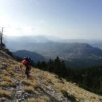
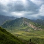
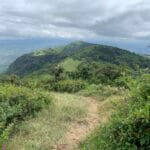
Experience the Ridge-Top Views, Wind-Turbines and Great Rift Panorama If you’re looking for a refreshing outdoor escape near Nairobi, the Ngong Hills Hiking Day offers one of Kenya’s most accessible yet spectacular hiking experiences. With rolling ridges, panoramic views over the Great Rift Valley, wind-turbines cutting silhouettes against the sky, and trails that ease you into nature just a short drive from the city, a Ngong Hills Hiking Day is both invigorating and memorable. In this article we’ll explore what exactly the Ngong Hills Hiking Day entails, how to prepare for it, practical details, the unique features of the Ngong Hills, what to expect, and plenty of tips. Whether you’re a fitness hiker, nature lover or traveller seeking a quick day trek from Nairobi, the Ngong Hills Hiking Day is worth your time. What Is a Ngong Hills Hiking Day? The Ngong Hills Hiking Day refers to a full-day excursion/hike along the ridge of the Ngong Hills, located just southwest of Nairobi. The idea is to dedicate one day—typically early morning to midday—to hiking, taking in the views, crests and ridges of the Ngong Hills, often summiting several ‘knuckles’ of the ridge, and returning to Nairobi by afternoon. The Ngong Hills Hiking Day is ideal for those wanting a nature break without requiring multi-day trekking. According to local guides, the full trail across the Ngong Hills ridge is about 12-14 km point-to-point and takes 3-4.5 hours for moderate pace. Many operators package the Ngong Hills Hiking Day with pickup from Nairobi, guided hike, refreshments and drop-off.  Where Are the Ngong Hills & Why They Feature for a Hiking Day Location & Geographic Significance The Ngong Hills form a distinctive ridge on the western edge of Nairobi, in Kajiado County, part of the Rift Valley escarpment. The peak elevation reaches about 2,460 m above sea level. From the eastern slopes you look toward Nairobi, from the western side you look down the vast Rift Valley drop. The term “Ngong” is derived from the Maasai phrase meaning “rhinoceros spring” or “eye of water”. Why It’s Ideal for a Day Hike Because the Ngong Hills are only some 20-30 km from Nairobi, they make for an excellent day trip. The terrain is manageable for many fitness levels (with moderate effort), vistas are rewarding, and the experience is distinct from urban life. A hiking day dedicated to Ngong Hills allows you to escape city noise, stretch your legs in fresh air, and return home the same afternoon. Guides note the hike is suitable for those with average fitness.  Key Highlights of the Ngong Hills Hiking Day When you embark on a Ngong Hills Hiking Day, here are some of the memorable features you’ll encounter: Ridge-Top Trails & Wind Turbines One of the signature visuals of the Ngong Hills Hiking Day is walking along grassy ridges with sweeping views of the Rift Valley on one side and Nairobi on the other. Many trails pass the wind-turbine installations – Kenya’s first utility-scale wind farm located on the northern slopes of Ngong Hills. The winds are often strong, adding to the sense of elevation and exposure, which makes the hike feel more adventurous. Panoramic Views & Nature During your Ngong Hills Hiking Day, you’ll get dramatic viewpoints: misty ridges, valley drops, Nairobi skyline glimpses, and on clear days you might see Mount Suswa and further distant peaks. The range also supports wildlife and birdlife, and though not a full wilderness expedition, hiking the hills offers a genuine nature fix. Cultural & Historical Backdrop The Ngong Hills also carry cultural and historical significance. From colonial times (the setting in the film “Out of Africa”) to Maasai heritage, the area weaves natural and human stories. The Ngong Hills Hiking Day includes small elements of that backdrop: from meeting locals to discovering the ridges once farmed by early settlers. Fitness, Trail Running & Day Escape Many locals use the Ngong Hills ridge for trail runs, hikes, and fitness outings. The Ngong Hills Hiking Day is equally suited to hikers and fitter individuals who may want to push pace, but is still accessible for a regular outdoor enthusiast. According to trekking guides, options of shorter loops or partial ridges exist for those wanting a lighter version.  Planning Your Ngong Hills Hiking Day Timing & Best Conditions For the best Ngong Hills Hiking Day experience, go early morning to avoid strong midday winds and to catch the views in calmer weather. The best times are during the dry seasons: January-March and June-October. Entry usually begins at 8:00 am; last entries are recommended before 4:00pm for safety.  Getting There & Logistics The starting point is near Ngong Town, about 22-25 km (≈45–60 minutes) southwest of Nairobi city centre. You can drive, take a taxi/ride-hail, or public transport to Ngong Town and then proceed to the Forest Reserve gate. Allow enough time for traffic and parking. Entrance fees apply (Kenyan citizens, residents, non-residents).  Route Overview & Duration For a typical Ngong Hills Hiking Day, the full ridge trail (seven hills) is about 12-14 km one-way or loop, and takes about 3-4.5 hours depending on pace and how many hills you summit. Many choose a more moderate version: climb two or three ridges, then return. Some tours package it as half day with transfer back to Nairobi. What to Pack and How to Prepare for Your Ngong Hills Hiking Day Essential Gear Physical & Safety Preparation Benefits and Significance of a Ngong Hills Hiking Day A Nature Escape Near the City For city dwellers and travellers to Nairobi alike, the Ngong Hills Hiking Day offers a quick but impactful nature escape. You get ridges, fresh air, sweeping views—without travelling far from the city. Physical & Mental Wellness Hiking the Ngong Hills ridge offers a great workout, strengthens lower-body muscles, challenges your stability, and boosts mental refreshment. The change of scenery, clean air and vantage points help rejuvenate. Environmental and Community Awareness Because the Ngong Hills form part of a forest reserve and water-catchment area,

Limuru Horse Trails: The Ultimate Horseback Riding Experience Near Nairobi

Horseback riding isn’t only for equestrians. In Limuru, it’s for anyone who wants quiet, nature, and a unique day out. Limuru Horse Trails offers a refreshing break from city life. You’ll ride through tea fields, forests, and rolling hills. The views are clean. The air is crisp. The silence is real. Also Read:Tafaria Castle: A Medieval Experience in Nyeri Here’s everything you need to know before heading out to the trails. A Quick Look at Limuru Horse Trails Limuru Horse Trails is located about 30 km from Nairobi. That’s a one-hour drive depending on traffic. The area sits at a high altitude, which means cool temperatures year-round. Riders don’t have to worry about intense heat or dust. The horse trails are part of a working tea farm. This gives you a blend of agriculture and adventure. Rides take you along private paths, forest corridors, and open fields. Why People Visit Limuru Horse Trails What to Expect on the Ride Most rides last between one and two hours. You can choose short beginner routes or longer scenic loops. A guide always joins the group, whether it’s your first time or your fiftieth. What You’ll See The trail is never crowded. You ride in small groups or private sessions. That makes it peaceful. Who Can Ride? Anyone. Riders as young as six years old can join. There are ponies for kids and full-sized horses for adults. No riding experience is needed. Horses are trained and calm. What About Total Beginners? If you’ve never ridden a horse before, the guides will show you everything. You’ll learn how to sit, hold the reins, and follow simple cues. Walks are slow and steady. Trotting is optional and only if you’re ready. There’s no pressure. The goal is a calm ride. How to Prepare for the Ride Don’t show up in sandals or shorts. This is a real ride. You’ll be outdoors for a while. Here’s what to bring: Helmets are provided. You don’t need to buy or bring one. When to Go Rides are available all year. Still, early mornings and late afternoons are the best. The light is soft, the weather cool, and the trails quiet. Best Months to Visit Avoid heavy rain days. Trails can be slippery. How Much It Costs Prices vary based on ride length and group size. As of 2025, here’s what to expect: Private group bookings are available. Advance booking is needed, especially on weekends. What Makes This Trail Different You’re not riding around a fenced track. You’re out in nature. On some trails, you’ll be the only group for miles. This makes Limuru Horse Trails unique compared to city-based riding clubs. Also, the horses aren’t overworked. The staff take pride in keeping them well-fed, well-trained, and happy. This makes your ride safe and enjoyable. Safety and Supervision Guides ride with every group. Each guide knows the trail, the horses, and how to assist riders. They carry communication devices in case of emergencies. All riders must wear helmets. There’s a short safety briefing before the ride begins. Booking and Contact Limuru Horse Trails doesn’t usually take walk-ins. It’s best to book in advance via phone or online. You can reach them through: Directions and maps are shared after booking. Add-On Activities Nearby Make your ride part of a full day trip. Nearby spots include: You can also bring your own picnic and relax after the ride. Great for Events and Occasions Limuru Horse Trails hosts: Custom packages can be arranged. Groups can pair rides with meals, cake, or private garden use. Reviews from Riders Ratings average 4.8 to 5 stars on local review sites. Sustainability and Community The trail supports eco-friendly tourism. Trails avoid harming vegetation. Horse manure is collected and used as fertilizer. Local youth are trained as guides and handlers. This creates jobs and builds pride in the area. No plastic bottles are sold on-site. Visitors are encouraged to carry reusable water bottles. Tips to Maximize Your Experience Let the team know if you have back problems or mobility concerns. They’ll match you with the right horse. Is It Worth It? Yes. If you want peace, nature, and something different, Limuru Horse Trails is one of the best places near Nairobi to get that. It’s not crowded, it’s not rushed, and it’s not expensive. You’ll leave relaxed, with great photos and stories. And you might even want to ride again. FAQs 1. How long are the rides at Limuru Horse Trails? Most rides are 1 to 2 hours long, but custom durations can be arranged. 2. Is it safe for kids? Yes. There are ponies for younger children and trained guides on all rides. 3. Do I need experience? No. Total beginners are welcome. Guides will help you from start to finish. 4. Are walk-ins allowed? No. You need to book in advance by phone or online. 5. What’s the cost? Expect to pay between KES 2,000 and 4,000 depending on duration and group size. 6. What if it rains? Rides are postponed during heavy rain. Light rain rides may continue based on your comfort. 7. Are there food options on-site? No meals are served on-site, but nearby cafes and tea farms offer meals. 8. Can I bring my own horse? No. Only their trained horses are used on the trails. 9. Is parking available? Yes. Free parking is available for guests with bookings. 10. Can I book for a special event? Yes. Custom rides for birthdays, proposals, or team days can be arranged.

Why Lukenya Hills Rock Climbing Is Worth Your Time

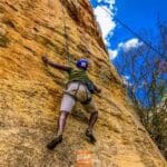
Lukenya Hills is less than 50 kilometers from Nairobi. It’s a popular destination for local climbers, but few international travelers know about it. If you’re looking for real rock climbing, not an indoor wall or a commercial zipline park, Lukenya delivers. It’s clean. It’s uncrowded. It’s affordable. And it offers some of the best granite routes in East Africa. Also Read:Mount Kenya Climbing & Trekking: Your Ultimate Adventure Guide A Detailed Explanation of Lukenya Hills Rock Climbing What Makes Lukenya Unique Lukenya is a large granite outcrop with over 300 established climbing routes. These range from beginner to advanced. The main rock faces are well-bolted, and the area is known for traditional climbing. This makes it an excellent place to train, push limits, or just enjoy nature while climbing safely. The crag is managed by the Mountain Club of Kenya (MCK), which controls access and maintains route safety. Day passes are affordable and funds go directly toward conservation. Key Climbing Areas at Lukenya There are four main climbing zones: 1. Main Wall This is the tallest wall in the area. Routes range from 20 to 60 meters. Most require trad gear. The rock is rough, providing great friction. 2. Upper Cliffs Perfect for beginner and intermediate climbers. Many top-rope routes here are under 25 meters. Easier walk-offs make it ideal for group climbs. 3. Mushroom Area Named for its unique rock shape. This area features short but technical routes. It’s popular for warm-ups or quick evening climbs. 4. Guardian Crag This is the overhanging wall for climbers seeking advanced challenges. Most routes are sport climbs with pre-placed bolts. When to Go You can climb year-round. Kenya’s equatorial climate means the rock dries fast even after rain. Best conditions: How to Get There Lukenya Hills is about a one-hour drive from Nairobi, depending on traffic. Most climbers use private cars or carpool. The final stretch is on a dirt road, passable in most vehicles. Pin location: Lukenya Academy, Machakos County. What to Bring The area is remote. Bring all your climbing gear, water, and snacks. Suggested gear: Safety and Rules There’s limited mobile reception. Let someone know your plans before heading out. Costs Access fees: Annual MCK membership is KES 3,000. It’s worth it if you plan to climb more than a few times. Camping: Who Should Climb at Lukenya Nearby Attractions If you want to mix in some non-climbing activities: Local Tips Why Lukenya Hills Is Growing in Popularity Word is spreading. More climbers are adding Lukenya to their bucket list. It’s cheaper than Kilimanjaro, closer than Hell’s Gate, and safer than many international spots. The community is friendly. Routes are documented. And you don’t need a guide unless you want one. Where to Learn More Visit the Mountain Club of Kenya website. They list all routes, events, and access details. Also check the Kenya Rock Climbing Facebook group for current conditions, climbing partners, and events. 10 Frequently Asked Questions 1. Do I need a guide? Not if you’re an experienced climber. But beginners will benefit from local guidance. 2. Can I rent gear there? No. Bring everything you need. 3. Is there water at the campsite? No. Bring at least 5 liters per person per day. 4. What’s the rock like? Granite. Sharp and grippy. Use older shoes. 5. Is it safe for solo travelers? Yes. But let someone know your plans. 6. Can I bring kids? Yes. Many families climb at Upper Cliffs. 7. Are there snakes? Rare, but yes. Be alert. 8. What’s mobile coverage like? Weak or none. Offline maps help. 9. Do I need to book in advance? No. But check if MCK has an event that day. 10. How do I become a member of MCK? Apply online at their website. Membership includes access to Lukenya and other climbing sites. Final Thoughts Lukenya Hills offers real climbing in wild terrain, minutes from Nairobi. It’s ideal for serious climbers looking to escape the gym, train hard, and connect with Kenya’s growing climbing community. If you’ve been searching for a place that combines access, variety, and peace — this is it.

Rurimeria Trail: Conquering the Aberdare Highlands

A Challenging yet Rewarding Hike Above the Clouds The Rurimeria Trail is one of Kenya’s most scenic and demanding hikes, offering an unforgettable adventure through the Aberdare Ranges. Known for its steep ascents, high-altitude bogs, and stunning ridgeline views, this trail is not for the faint of heart but promises incredible rewards for determined hikers. Located in Nyandarua County, the trail leads adventurers into the moorlands of the Aberdares, through unique alpine vegetation and dramatic landscapes. The Rurimeria Trail is popular among experienced hikers training for tougher expeditions like Mount Kenya or Kilimanjaro, but it also attracts nature enthusiasts eager to push their limits while enjoying the pristine beauty of Kenya’s highlands. Location and Geography of the Rurimeria Trail Where the Rurimeria Trail is Found The Rurimeria Trail is tucked within the scenic Aberdare Ranges, close to Engineer town in Nyandarua County. Access is via the Ndunyu Njeru side of the Aberdare Conservation Area, making it one of the less-traveled routes into the highlands. From Nairobi, it’s about 120 kilometers away—roughly a 3–4 hour drive, depending on traffic and weather conditions. The trail begins in cultivated farmlands at the foothills, giving hikers a glimpse of rural Kenyan life, before ascending steeply into the montane forest. From here, the hike moves through dense bamboo forests, which are often misty and mysterious, before opening up into the iconic Aberdare moorlands that define the high-altitude sections of the Rurimeria Trail. Natural Landscape The Rurimeria Trail climbs to altitudes exceeding 3,800 meters above sea level, placing hikers in one of Kenya’s most unique ecosystems. The landscapes are striking, with giant lobelias standing tall among tussock grasses, alpine bogs stretching out like natural carpets, and hardy heather shrubs painting the hillsides. As hikers move along ridges and valleys, they are treated to breathtaking views of Mount Satima and, on especially clear days, the snow-capped peaks of Mount Kenya in the distance. These transitions—from farmlands to bamboo forests to alpine moorlands—make the trail an ecological journey, showcasing the rich diversity of the Aberdares. The Hiking Experience on the Rurimeria Trail Difficulty Level The Rurimeria Trail is widely considered one of the more challenging hikes in the Aberdares. Its steep gradients demand stamina, while boggy and slippery sections test balance and patience. The unpredictable highland weather adds another layer of difficulty—sunshine, mist, rain, and biting cold can all occur in a single day. However, the challenge is part of the charm, and the sense of victory at the summit is unmatched. Duration and Distance Most hikes on the Rurimeria Trail take 6–8 hours round trip, covering between 18–20 kilometers depending on the exact route taken. Early starts are highly recommended, not only to maximize daylight but also to avoid the thick fog that often rolls in by afternoon, obscuring visibility on the ridges. The Summit Experience The culmination of the trail is Rurimeria Hill, a ridge that provides sweeping 360-degree views of the Aberdare highlands. From this vantage point, hikers can admire the Kinangop Plateau, Mount Satima, and even glimpses of Mount Kenya shimmering on the horizon. Standing here, surrounded by the vast moorland, gives hikers the exhilarating sensation of being “on top of the world.” Unique Features of the Rurimeria Trail The Bamboo and Heather Zone After leaving the farmlands, hikers enter a thick bamboo zone. This section is often damp and slippery, with narrow passages that make footing tricky. Emerging from the bamboo, hikers enter the heather zone, where shrubs dominate and the air feels cooler and fresher. This transition marks the shift into the moorland environment, which is dotted with alpine flowers and hardy vegetation adapted to the altitude. The Alpine Bogs Perhaps the most famous—and challenging—feature of the Rurimeria Trail is its alpine bogs. These soggy, waterlogged areas demand slow and careful movement, with some sections forcing hikers to hop from tussock to tussock to avoid sinking into the mud. Though exhausting, the bogs showcase the unique hydrology of the Aberdare ecosystem and make the trail truly distinctive. Flora and Fauna The trail is alive with unique plant life, including giant lobelias, senecios, and tussock grasses, all adapted to survive the cold, misty conditions. Wildlife encounters are also possible—lower down, hikers might spot bushbucks and colobus monkeys, while bird enthusiasts can enjoy sightings of malachite sunbirds, eagles, and Jackson’s francolins soaring or flitting across the ridges. Why Hike the Rurimeria Trail? Perfect Training Ground Because of its high altitude and challenging terrain, the Rurimeria Trail is frequently used by climbers as a training ground for bigger expeditions like Mount Kenya or Kilimanjaro. It provides an excellent opportunity to test stamina, acclimatize to altitude, and build resilience. Stunning Scenery From mist-draped ridges to panoramic views of valleys and neighboring peaks, the trail offers photographers and nature lovers endless opportunities for breathtaking shots. The dramatic play of light and cloud over the moorland is especially magical. Less Crowded Unlike more popular trails in the Aberdares, the Rurimeria Trail remains relatively quiet. This solitude enhances the hiking experience, allowing trekkers to connect deeply with nature and enjoy peaceful moments of reflection. Travel Guide to the Rurimeria Trail Best Time to Visit The best time to attempt the Rurimeria Trail is during the dry months of January–March and June–October. During the rainy seasons, the bogs swell with water and the trail becomes dangerously muddy, making progress slow and sometimes unsafe. What to Pack Getting There From Nairobi, take the Nairobi–Naivasha highway, branching off toward Engineer town in Nyandarua County. The last stretch to the trailhead can be rough, so a 4×4 vehicle is recommended, particularly in the rainy season. Safety and Conservation Safety Tips Conservation Efforts The Kenya Forest Service, together with local community groups, actively work to conserve the fragile ecosystem of the Rurimeria moorlands. Visitors are encouraged to practice responsible tourism, which includes carrying out all litter, staying on marked paths, and respecting the delicate alpine vegetation. Accommodation Options Near Rurimeria Budget Stays Affordable guesthouses in Engineer town offer simple accommodation for hikers who

Gicheru Mines: Kenya’s Forgotten Quarry Adventure

A Hidden Gem Near Nairobi Gicheru Mines are an intriguing blend of history, nature, and adventure tucked away in Kiambu County, just a short drive from Nairobi. Once an active quarry where stones were mined decades ago, the site has since transformed into a unique outdoor attraction. Today, it draws hikers, photographers, and curious explorers eager to experience the abandoned mine tunnels, towering rock faces, and scenic trails that weave through its rugged terrain. Unlike mainstream hiking spots, Gicheru Mines offers something raw and mysterious. Walking through the tunnels or standing at the edge of the cliffs, you can’t help but feel a mix of awe and curiosity about the history etched into the rocks. Location and Geography of Gicheru Mines Where Gicheru Mines Are Found Gicheru Mines are located in the Kikuyu escarpment region of Kenya, specifically near Kamangu area in Kiambu County, approximately 30 km from Nairobi. The mines lie in the heart of central highlands, surrounded by rolling tea plantations, small-scale farms, and scattered homesteads. The Natural Setting The site is characterized by rugged cliffs, abandoned quarry pits, hidden caves, and vegetation reclaiming the mined areas. Over time, nature has softened the harsh scars of mining with green shrubs, grasses, and even small trees sprouting between cracks in the rocks. This juxtaposition of industry and wilderness makes Gicheru Mines visually captivating and unique. History of Gicheru Mines Origins as a Quarry The mines were originally established as a quarrying site for building stones. Workers extracted rocks for construction, and over the years, deep pits and caves were created. These caves still remain, some extending into dark, mysterious tunnels. Abandonment and Transformation After the quarrying activities ceased, the site was abandoned. Nature slowly began to reclaim it, turning it into a rugged, otherworldly landscape. Local adventurers started exploring the site, and it gained popularity as an offbeat hiking destination. Today, Gicheru Mines stand as a reminder of Kenya’s quarrying past while serving as a modern playground for exploration. Hiking and Exploration at Gicheru Mines Hiking Trails The trails at Gicheru Mines are moderately challenging, weaving through rocky outcrops, cliffs, and overgrown vegetation. Most hikes take 2–4 hours depending on pace and the depth of exploration. The Caves and Tunnels One of the highlights is exploring the dark caves and tunnels left behind by quarrying. They vary in size—some are tall and wide enough to walk through comfortably, while others require crouching and careful movement. Hikers are advised to carry torches for safety. Rock Formations and Cliffs The towering cliffs and dramatic rock formations are ideal for photography. Some cliffs provide panoramic views of the surrounding countryside, rewarding hikers with stunning scenery after the effort. Activities to Enjoy at Gicheru Mines Hiking and Adventure Tourism Most visitors come to hike and explore the unique geology of the site. Adventurous groups often challenge themselves by venturing deep into the caves or climbing the rocky slopes. Photography and Videography The mine’s rugged terrain, moody caves, and contrasting greenery create dramatic photo opportunities. It’s also a favorite spot for videographers and content creators seeking cinematic backdrops. Team Building and Group Activities The open grounds, cliffs, and tunnels make Gicheru Mines ideal for team-building exercises, group adventures, and educational geology tours. Travel Guide to Gicheru Mines How to Get There From Nairobi, drive toward Kiambu town and follow local routes leading into the countryside. The journey takes about 1–1.5 hours by private car. Public transport options are also available, though hiking groups often organize trips. Best Time to Visit The mines can be visited year-round, but the dry season (June–October and December–February) is best for hiking. During the rainy season, trails and caves may become slippery and dangerous. What to Carry Safety and Conservation at Gicheru Mines Safety Guidelines Conservation Efforts Though not an official conservancy, local communities and hiking groups emphasize eco-friendly practices at Gicheru Mines. Visitors are encouraged to avoid littering and to respect the natural reclamation of the site. Accommodation Options Budget-Friendly Options Guesthouses and budget hotels in Kiambu town provide affordable stays for day-trippers. Mid-Range and Luxury Options For those combining Gicheru Mines with broader highland exploration, resorts in Limuru and Tigoni offer more comfort, often with views of tea plantations. Why Visit Gicheru Mines? Unique Adventure Unlike traditional hiking spots, Gicheru Mines offer a raw, rugged experience combining caves, cliffs, and quarry history. Close to Nairobi At just about an hour from Nairobi, it’s perfect for weekend getaways and day trips. Rich in History and Scenery The abandoned quarry tells a story of industry reclaimed by nature, creating a landscape full of intrigue and beauty. Also read:Off-the-Beaten-Path Destinations in Kenya Wrap up Gicheru Mines is more than just an abandoned quarry—it’s a living story of history, nature, and adventure. Its caves, cliffs, and rugged trails invite explorers to experience a side of Kenya that blends industrial past with natural beauty. Whether you’re a hiker, photographer, or weekend adventurer, Gicheru Mines promises mystery, challenge, and unforgettable views just a short drive from Nairobi. FAQs About Gicheru Mines 1. Where are Gicheru Mines located? They are in Kiambu County, about 30 km from Nairobi. 2. What makes Gicheru Mines unique? Its combination of abandoned quarry caves, cliffs, and rugged terrain makes it different from ordinary hiking trails. 3. How long does a typical hike take? Most hikes last 2–4 hours depending on the route and exploration of caves. 4. Are the caves safe to enter? Yes, but hikers should carry torches and move cautiously in groups. 5. Is Gicheru Mines suitable for beginners? Yes, the trails are moderately challenging but manageable for first-time hikers. 6. Can I visit Gicheru Mines with kids? It’s not ideal for very young children due to cliffs and caves, but older kids can enjoy with supervision. 7. What should I carry for the hike? Hiking boots, water, snacks, a torch, and a camera are essentials. 8. Do I need a guide for Gicheru Mines? While not mandatory, having a local guide or joining a

The Sleeping Warrior Hike: Conquering Nature’s Silent Giant

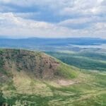
An Epic Adventure in the Great Rift Valley The Sleeping Warrior Hike is one of Kenya’s most fascinating and rewarding outdoor adventures. Located in the heart of the Great Rift Valley near Lake Elementaita in Nakuru County, this hike offers sweeping views, cultural depth, and the thrill of conquering a dormant volcanic formation shaped like a warrior lying on his back. Named for its uncanny resemblance to a resting Maasai warrior when viewed from a distance, The Sleeping Warrior Hike attracts both local and international hikers seeking a mix of challenge, beauty, and cultural storytelling. Location and Geography of The Sleeping Warrior Where The Sleeping Warrior is Found The Sleeping Warrior is situated between Lake Elementaita and Lake Nakuru, about 140 km from Nairobi. The hike begins near the shores of Lake Elementaita, a UNESCO World Heritage Site famous for flamingos, pelicans, and hot springs. The Unique Landscape The hike leads across savannah grasslands, acacia woodlands, volcanic ridges, and rocky outcrops. From the summit, hikers are rewarded with stunning views of Lake Naivasha to the east, Lake Nakuru to the west, and the shimmering turquoise waters of Lake Elementaita directly below. The Experience of The Sleeping Warrior Hike The Trail The Sleeping Warrior Hike generally takes 4–6 hours round trip, depending on pace and chosen route. Hikers begin with a gentle walk across plains, often spotting zebras, antelopes, and grazing cattle along the way. As the trail progresses, the climb becomes more demanding with steep ascents across volcanic ridges. The path zigzags up rocky slopes, testing endurance but rewarding hikers with unmatched scenery. Reaching the Summit At the peak of The Sleeping Warrior Hike, one can clearly see the warrior’s “chest” and “face.” Standing here feels like walking atop a giant asleep in stone. The panoramic views are awe-inspiring, offering one of the most Instagram-worthy experiences in Kenya. Cultural and Historical Significance Maasai Heritage The formation is named after the Maasai warrior because of its resemblance to a reclining fighter. To the Maasai, it carries cultural significance and is often tied to local legends of bravery, rest, and the bond between people and land. Colonial Era History During the colonial period, the area around Lake Elementaita was home to settlers who built ranches. Oral histories link the ridge to early resistance struggles, making it a place layered with cultural and historical meaning. Activities to Combine with The Sleeping Warrior Hike Birdwatching at Lake Elementaita After the hike, many visitors enjoy birdwatching by the lake. With more than 400 bird species, including flamingos, pelicans, and fish eagles, the lake is a birder’s paradise. Hot Springs Visit The shores of Lake Elementaita feature natural hot springs, where hikers can relax and soothe their muscles after the trek. Game Viewing Nearby conservancies and Lake Nakuru National Park offer excellent opportunities to spot rhinos, giraffes, lions, and buffalo. Travel Guide to The Sleeping Warrior Hike Best Time to Visit The hike is best done during the dry seasons (June–October and December–February) when trails are less slippery and visibility is clear. Early mornings are perfect for avoiding the midday heat. How to Get There From Nairobi, take the Nairobi–Nakuru highway (A104). The drive takes about 2.5–3 hours. Local guides are available in the area to assist hikers. What to Carry Safety and Conservation at The Sleeping Warrior Safety Tips Conservation Efforts The Sleeping Warrior lies within the Lake Elementaita Wildlife Sanctuary, which is a protected area under UNESCO. Visitors are encouraged to leave no litter, respect wildlife, and support eco-tourism initiatives that benefit local Maasai communities. Accommodation Options Budget-Friendly Stays Mid-Range and Luxury Options Why You Should Do The Sleeping Warrior Hike A Unique Hiking Experience Unlike other hikes in Kenya, The Sleeping Warrior Hike combines volcanic landscapes, wildlife, lakeside views, and cultural storytelling. Accessibility Just a short drive from Nairobi, the hike makes for a perfect day trip or weekend adventure. Unmatched Scenic Beauty The mix of volcanic ridges, Rift Valley plains, and glittering lakes makes this hike one of the most scenic in East Africa. Wrap up The Sleeping Warrior Hike is a spectacular adventure that blends nature, culture, and history into one unforgettable experience. From its dramatic volcanic landscapes to its panoramic views of the Rift Valley and shimmering lakes, this hike offers more than just exercise—it offers a journey into Kenya’s soul. For anyone seeking a unique outdoor experience near Nairobi, The Sleeping Warrior Hike deserves a top spot on your adventure list. Also read:Hidden Gems in Naivasha: Secret Side of Kenya’s Lake Town FAQs About The Sleeping Warrior Hike 1. Where is The Sleeping Warrior located? It’s near Lake Elementaita in Nakuru County, about 140 km from Nairobi. 2. Why is it called The Sleeping Warrior? Because the ridge resembles a Maasai warrior lying on his back when viewed from a distance. 3. How long does The Sleeping Warrior Hike take? Typically 4–6 hours round trip, depending on pace and chosen route. 4. What should I carry for The Sleeping Warrior Hike? Water, snacks, hiking shoes, sunscreen, and a camera are essentials. 5. Is The Sleeping Warrior Hike difficult? It’s moderately challenging, with steep ascents but manageable for most hikers with average fitness. 6. Can I spot wildlife during the hike? Yes, zebras, gazelles, and birds are common around the plains, especially near Lake Elementaita. 7. Is it safe to hike The Sleeping Warrior? Yes, but it’s recommended to hike in groups or with a local guide. 8. What’s the best time to do The Sleeping Warrior Hike? During the dry seasons—June to October and December to February—for better visibility and safer trails. 9. Are there accommodations near The Sleeping Warrior? Yes, ranging from budget campsites to luxury lodges like Elementaita Serena Camp.10. Why should I do The Sleeping Warrior Hike? Because it combines panoramic Rift Valley views, cultural history, volcanic landscapes, and a rewarding hiking challenge

7 Jaw-Dropping Mount Kenya Climbing & Trekking Secrets Revealed

Do you dream of standing on the slopes of Africa’s second-highest peak? If so, Mount Kenya climbing and trekking should be at the top of your bucket list. This iconic mountain, located in central Kenya, offers a diverse range of experiences, from hiking to technical climbs, making it perfect for adventurers of all skill levels. In this article, you’ll get a detailed breakdown of everything you need to know about climbing Mount Kenya, including its various routes, the best time to trek, what to pack, and tips for a safe and successful journey. Whether you’re a beginner or an experienced climber, we’ve got you covered. A Detailed Explanation of Mount Kenya Climbing and Trekking What makes Mount Kenya climbing and trekking so special? For starters, it’s not just about conquering a peak—it’s about immersing yourself in a stunning UNESCO World Heritage Site known for its breathtaking landscapes, unique flora and fauna, and cultural significance. Mount Kenya stands tall at 5,199 meters (17,057 feet), and its highest peaks—Batian, Nelion, and Point Lenana—offer different challenges for trekkers and climbers alike. Here’s everything you need to know about planning your Mount Kenya trek. Overview of Mount Kenya’s Peaks and Routes Mount Kenya has three main peaks: Batian (5,199m), Nelion (5,188m), and Point Lenana (4,985m). While Batian and Nelion require technical climbing skills, Point Lenana is accessible to non-technical climbers, making it the most popular trekking destination. The mountain has several trekking routes, each offering a unique experience. Let’s break down the most popular ones: The Best Time to Climb Mount Kenya Timing is crucial when planning your Mount Kenya trek. The mountain’s climate varies dramatically depending on the season. While it is possible to climb year-round, the best time for trekking is during the dry seasons, which fall between January to March and June to October. During the rainy seasons (April-May and November-December), trails can become slippery and challenging. These months are best avoided unless you’re prepared for the added difficulty. What to Pack for Mount Kenya Climbing and Trekking Packing the right gear is essential for a successful and comfortable climb. Here’s a comprehensive list of items you’ll need for your Mount Kenya trek: Clothing: Essential Gear: Other Essentials: Acclimatization and Safety Tips for Mount Kenya Climbers Trekking at high altitudes comes with its own set of challenges, especially the risk of altitude sickness. To reduce the risk, it’s important to acclimatize properly. Here are some tips: For safety, always trek with a certified guide who knows the routes and can assist in case of emergencies. Wildlife and Biodiversity on Mount Kenya Mount Kenya is a treasure trove of biodiversity. As you trek, you’ll pass through different ecological zones, each with its own unique flora and fauna. Mount Kenya’s rich biodiversity makes the trek not only a physical challenge but also an educational journey into one of Africa’s most unique ecosystems. 10 Frequently Asked Questions (FAQs) Mount Kenya climbing and trekking is a must-do adventure for anyone seeking a blend of physical challenge, cultural immersion, and natural beauty. With multiple routes to choose from, breathtaking scenery, and the chance to stand on the roof of Africa, this trek is an unforgettable experience. Pack well, acclimatize slowly, and get ready to create memories that will last a lifetime!

The 5 BEST Kenya Mountains For Hiking And Trekking In 2025

When you think of Kenya, images of the sprawling savannahs and wildlife-filled plains often come to mind. But beyond its iconic safaris, Kenya is also home to stunning mountain ranges that offer some of the best hiking and trekking opportunities in Africa. Whether you’re looking to conquer the snow-capped peaks of Mount Kenya or explore the misty forests of the Aberdare Ranges, Kenya’s mountains promise breathtaking landscapes and unique challenges for adventurers of all skill levels. In this guide, you’ll discover the best mountains to hike in Kenya, along with practical trekking tips to make your experience safe, enjoyable, and unforgettable. From essential packing lists to altitude considerations, this article has everything you need to prepare for an epic mountain adventure in Kenya. A Detailed Explanation of Exploring Kenya’s Mountains: Hiking and Trekking Tips 1. Mount Kenya: Africa’s Second-Highest Peak Why Hike Mount Kenya?Mount Kenya is Africa’s second-highest mountain after Kilimanjaro, and it offers a diverse range of trekking routes for both seasoned hikers and beginners. The mountain’s jagged peaks, glaciers, and stunning valleys provide a challenging yet rewarding trekking experience. Its highest peaks, Batian and Nelion, require technical climbing skills, but Point Lenana (4,985 meters) is accessible to non-technical trekkers and offers spectacular sunrise views over the African plains. Popular Routes on Mount Kenya Tips for Trekking Mount Kenya Pro Tip: Plan your trek during the dry seasons (January to March and July to October) for the best conditions and clear views. Also read; Top Ten Best Hiking Trails In Kenya 2. Aberdare Ranges: Trekking Through Misty Forests Why Hike the Aberdare Ranges?The Aberdare Ranges are a hidden gem for hikers, offering a unique blend of thick rainforests, bamboo groves, and moorlands. The highest peak, Ol Donyo Lesatima (4,001 meters), and other summits like Kinangop provide challenging hikes with stunning views of the Rift Valley. The Aberdares are also home to diverse wildlife, including elephants, buffaloes, and leopards, adding an element of adventure to the trek. Popular Trails in the Aberdares Tips for Trekking in the Aberdare Ranges Pro Tip: Visit the Aberdare National Park during the dry seasons (January to February and June to September) for better trail conditions. 3. Mount Elgon: An Untamed Wilderness Why Hike Mount Elgon?Mount Elgon, straddling the border between Kenya and Uganda, is an ancient volcanic mountain with a massive caldera and unique caves carved by elephants. It’s an ideal destination for those seeking a less crowded trekking experience. The Kenyan side of the mountain is part of the Mount Elgon National Park, offering trails through montane forests, giant heather zones, and rocky peaks. Popular Routes on Mount Elgon Tips for Trekking Mount Elgon Pro Tip: Combine your hike with a visit to nearby Saiwa Swamp National Park, home to the rare sitatunga antelope. 4. Loita Hills: A Cultural Trekking Experience Why Hike Loita Hills?For trekkers seeking a blend of cultural immersion and stunning landscapes, the Loita Hills in southwestern Kenya are a perfect choice. These hills are traditionally home to the Maasai community, and trekking here offers a chance to interact with Maasai guides and learn about their way of life. The trails traverse through lush forests, open moorlands, and rocky ridges, offering breathtaking views over the Great Rift Valley. Popular Trails in Loita Hills Tips for Trekking in Loita Hills Pro Tip: Visit during the Maasai festivals or community gatherings for a chance to experience traditional dances and ceremonies. 5. Cherangani Hills: Off-the-Beaten-Path Adventure Why Hike Cherangani Hills?Located in Kenya’s western highlands, the Cherangani Hills are often overlooked but offer beautiful trekking opportunities for those seeking solitude. The hills feature rolling moorlands, indigenous forests, and spectacular ridges. The region is home to the Pokot and Marakwet communities, offering cultural encounters alongside natural beauty. Popular Trails in the Cherangani Hills Tips for Trekking in Cherangani Hills Pro Tip: Visit the nearby Kapenguria Museum to learn about Kenya’s history, including the detention of the Kapenguria Six, a pivotal moment in the country’s struggle for independence. FAQs About Hiking and Trekking in Kenya Conclusion Kenya’s mountains offer a diverse range of trekking experiences that cater to adventurers of all levels. Whether you’re scaling the lofty peaks of Mount Kenya or exploring the remote trails of the Cherangani Hills, these landscapes promise breathtaking views and encounters with nature that will stay with you long after your trek. With the right preparation, respect for nature, and a sense of adventure, hiking in Kenya will be a truly unforgettable experience. So lace up your boots, pack your gear, and get ready to explore the hidden gems of Kenya’s highlands!

Top Hiking Trails in Kenya: Best Routes for unique Adventures

Kenya is a country known for its awe-inspiring wildlife, vast savannahs, and vibrant culture, but beyond the classic safari experience, there’s another side to Kenya that draws adventurers from around the world—its stunning hiking trails. From volcanic craters to lush forests and majestic mountains, Kenya offers a wide range of hiking opportunities for outdoor enthusiasts of all levels. Whether you’re a seasoned trekker looking for a challenge or a casual hiker wanting to explore nature, the country’s diverse landscapes offer something for everyone. In this blog, we’ll explore the best hiking trails and routes in Kenya, highlighting each destination’s unique features and providing helpful tips to make the most of your hiking adventure.  Also read; Top Ten Best Hiking Trails In Kenya 1. Mount Kenya Mount Kenya, the second-highest mountain in Africa after Kilimanjaro, is the crown jewel of Kenya’s hiking and climbing scene. It’s a UNESCO World Heritage Site and offers some of the most breathtaking hiking trails in the country. Mount Kenya has several peaks, the highest being Batian (5,199 meters), which is only accessible to technical climbers. However, for hikers, reaching Point Lenana (4,985 meters) is a challenging yet achievable goal. What to Expect: Highlights: Tips: 2. Mount Longonot Mount Longonot, located just 60 kilometers northwest of Nairobi, is a popular day hike for locals and tourists alike. This dormant volcanic mountain offers an exciting trek to its crater rim and an optional loop hike around the crater itself. What to Expect: Highlights: Tips: 3. Hell’s Gate National Park Hell’s Gate National Park is one of the few places in Kenya where you can hike and bike alongside wildlife without the need for a guide. Located near Lake Naivasha, about 90 kilometers from Nairobi, the park is famous for its dramatic landscapes, including towering cliffs, deep gorges, and geothermal hot springs. What to Expect: Highlights: Tips: 4. Aberdare Ranges The Aberdare Ranges, located within the Aberdare National Park, offer some of the most scenic and less-trodden hiking routes in Kenya. This lush, mountainous region is known for its misty forests, waterfalls, and abundant wildlife, including elephants and leopards. What to Expect: Highlights: Tips: 5. Chyulu Hills The Chyulu Hills, located between Amboseli and Tsavo West National Parks, are often described as “The Green Hills of Africa” and are famous for their scenic beauty and dramatic volcanic landscapes. The hills are a perfect destination for hikers looking for solitude and sweeping views. What to Expect: Highlights: Tips: 6. Karura Forest For those looking for an easy and family-friendly hike close to Nairobi, Karura Forest is a perfect choice. Located just outside the city, this urban forest offers well-maintained trails through lush greenery, waterfalls, and caves. What to Expect: Highlights: Tips: 7. Ngong Hills Just a short drive from Nairobi, the Ngong Hills offer stunning views of the Great Rift Valley and Nairobi city. This series of ridges and peaks provides a refreshing escape from the city and is a popular spot for hiking, picnics, and even paragliding. What to Expect: Highlights: Tips: FAQs Conclusion Kenya offers a diverse array of hiking opportunities that allow travelers to explore the country’s incredible natural beauty beyond the famous safaris. Whether you’re scaling the heights of Mount Kenya, enjoying the volcanic landscapes of Mount Longonot, or wandering through the lush Aberdare Ranges, hiking in Kenya is a rewarding experience for adventurers of all levels. By exploring these trails, you’ll gain a deeper appreciation for the country’s varied landscapes, unique wildlife, and rich cultural heritage. So lace up your hiking boots, grab your backpack, and get ready to discover Kenya on foot!

10 Best Hikes and Trails in Kenya

Kenya is a country of remarkable diversity, offering some of the most stunning landscapes in Africa. From soaring mountains to vast savannahs, Kenya is a hiker’s paradise. Whether you’re an experienced trekker or a casual walker, the hiking trails in Kenya provide an unforgettable experience. So, what are the best hiking trails in Kenya that you should explore? In this article, we will take you on a journey through Kenya’s most captivating hiking trails. From the challenging ascent of Mount Kenya to the serene walks in Hell’s Gate, we’ve got you covered. We’ll also offer insights into what makes each trail unique, what you need to prepare for your hike, and how to ensure a safe and enjoyable adventure. Let’s dive into the heart of Kenya’s wilderness. Also read: A Guide to National Parks and Reserves in Kenya A Detailed Explanation of Hiking Trails in Kenya 1. Mount Kenya: Conquer the Country’s Highest Peak Why hike Mount Kenya? If you’re looking for a challenging yet rewarding hike, Mount Kenya should be at the top of your list. As Africa’s second-highest peak, this iconic mountain offers a range of trails catering to different skill levels. Main Trails: The most popular routes include the Sirimon, Naro Moru, and Chogoria routes. Each trail offers a unique perspective of the mountain’s beauty, with varying levels of difficulty. The Sirimon route is known for its gradual ascent and stunning views, making it ideal for beginners. The Naro Moru route is the fastest but steepest, while the Chogoria route is considered the most scenic, with breathtaking landscapes and fewer crowds. What to Expect: Hikers can expect to traverse through lush rainforests, moorlands, and rocky peaks. The highlight is reaching Point Lenana, the third-highest peak, where the sunrise views are nothing short of spectacular. Preparation Tips: To tackle Mount Kenya, you need to be physically fit and well-prepared. Altitude sickness is a real risk, so it’s essential to acclimatize properly. Hiring a local guide is recommended for safety and navigation. 2. Hell’s Gate National Park: Walk Among Wildlife What makes Hell’s Gate unique? Unlike many other national parks in Kenya, Hell’s Gate allows you to explore on foot or by bicycle. This freedom lets you immerse yourself in the dramatic landscapes and get up close with wildlife. Main Trails: The main hiking trail takes you through the Njorowa Gorge, a scenic and somewhat challenging route with steep climbs and narrow passages. The trail offers fantastic views of the surrounding cliffs and the chance to spot wildlife such as zebras, giraffes, and even buffaloes. What to Expect: Hell’s Gate is famous for its towering cliffs, deep gorges, and geothermal hot springs. The Olkaria Geothermal Spa, located within the park, is a perfect spot to relax after your hike. Preparation Tips: Bring plenty of water, sunscreen, and a hat, as the park can get quite hot during the day. Comfortable hiking shoes are a must, especially if you plan to explore the gorge. 3. The Aberdare Ranges: Explore the Highlands Why visit the Aberdare Ranges? The Aberdare Ranges offer a completely different hiking experience, with misty forests, bamboo groves, and waterfalls. It’s an excellent choice for those who prefer cooler, high-altitude hikes. Main Trails: One of the most popular trails is the Elephant Hill trail, known for its steep ascent and challenging terrain. Other trails, like the Satima Peak and Karuru Falls, offer equally rewarding experiences with panoramic views and beautiful flora. What to Expect: The Aberdare Ranges are home to diverse wildlife, including elephants, leopards, and the elusive bongo antelope. The trails are surrounded by dense forests and offer a chance to see some of Kenya’s most spectacular waterfalls, like the Gura Falls and Karuru Falls. Preparation Tips: Due to the high altitude and dense vegetation, the trails can be slippery and challenging. Proper hiking boots, warm clothing, and a raincoat are essential. Hiring a guide is recommended, especially for longer treks. 4. Ngong Hills: A Quick Escape from Nairobi Why hike the Ngong Hills? Just a short drive from Nairobi, the Ngong Hills are perfect for a day hike. The rolling hills offer stunning views of the Great Rift Valley and Nairobi’s skyline. Main Trails: The hike along the Ngong Hills ridge is about 12 kilometers long, with several peaks to conquer. The trail can be windy, adding an extra challenge, but the panoramic views are worth it. What to Expect: The Ngong Hills are a popular spot for both locals and tourists, offering a refreshing break from the city’s hustle and bustle. Along the trail, you’ll pass through grassy knolls and might encounter local herders with their livestock. Preparation Tips: The trail is relatively straightforward, but the winds can be strong, so dress accordingly. Carry snacks and water, as there are no facilities along the trail. It’s also advisable to start early to avoid the afternoon heat. 5. Mount Longonot: A Volcanic Adventure What makes Mount Longonot special? Mount Longonot is an extinct volcano located within the Great Rift Valley. The hike to the summit and around the crater rim offers an exhilarating experience with stunning views of the surrounding landscape. Main Trails: The trail to the summit is about 3.1 kilometers, with a steep and rugged climb. Once at the top, hikers can choose to walk around the crater rim, which adds an additional 7.2 kilometers to the hike. What to Expect: The climb is challenging but short, taking about 4-5 hours to complete. The views from the summit are incredible, offering a 360-degree panorama of the Rift Valley, Lake Naivasha, and the surrounding plains. Preparation Tips: The trail is steep and can be exhausting, so pace yourself. Bring plenty of water, as the area is quite dry and there are no water sources on the trail. A hat and sunscreen are also essential. 6. The Chyulu Hills: A Hidden Gem Why explore the Chyulu Hills? The Chyulu Hills are one of Kenya’s lesser-known hiking destinations, offering pristine wilderness and spectacular views. The hills