Thinking of escaping the usual hiking circuits in Kenya? The Mount Elgon Trail Hike Challenge is the underrated route you’ve been missing. While most flock to Mount Kenya or the Aberdares, Mount Elgon waits quietly on the border of Kenya and Uganda. It’s one of the oldest extinct volcanoes in East Africa, and its untouched trails deliver solitude, scenery, and serious elevation gains.
If you want a physically demanding trek that rewards every step, this is it.
Also Read:Mount Kenya Climbing & Trekking: Your Ultimate Adventure Guide
A Detailed Explanation of the Mount Elgon Trail Hike Challenge
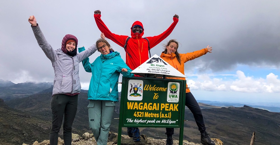
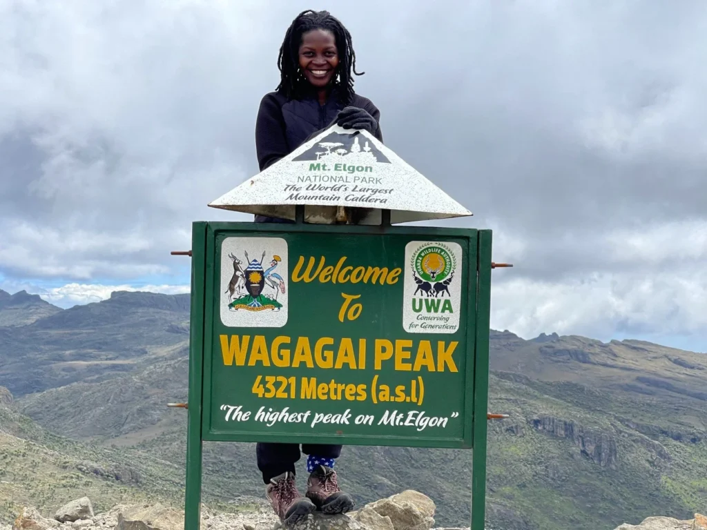
Mount Elgon stands at 4,321 meters at its highest point, Wagagai Peak. On the Kenyan side, Koitoboss Peak is the highest at 4,222 meters. It’s not the tallest mountain in the region, but it offers a rewarding hiking experience with less human traffic and more natural beauty.
The challenge lies in its terrain, weather shifts, and remoteness.
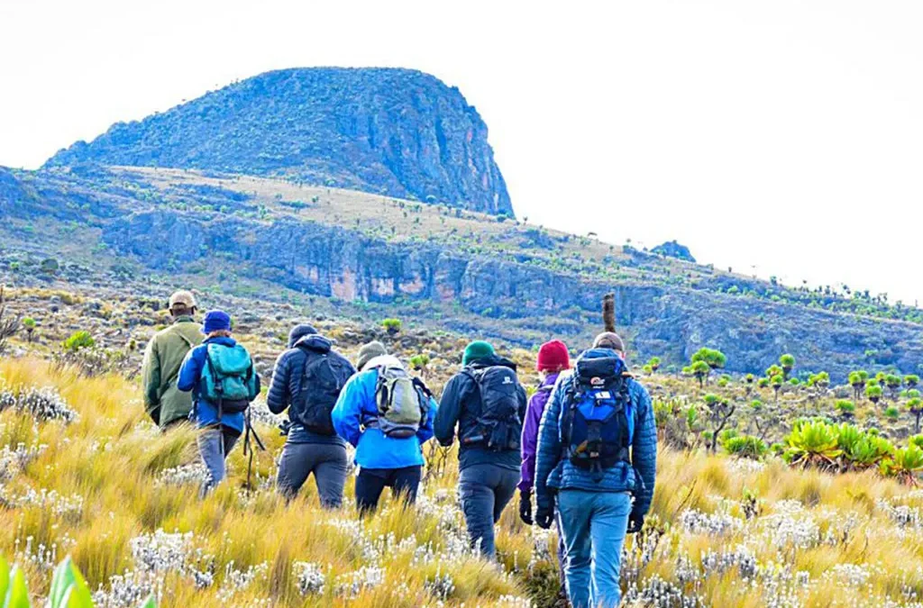
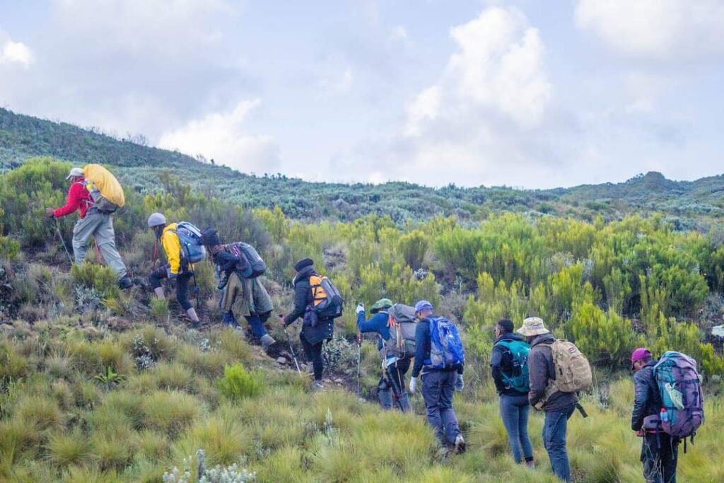
The Mount Elgon Trail Hike Challenge involves multi-day trekking through dense forests, bamboo zones, moorlands, and volcanic craters. It demands endurance, navigation skills, and a respect for the mountain’s moods.
Why Choose Mount Elgon Over More Popular Trails?
- Low Foot Traffic: Unlike Mount Kenya, you won’t bump into dozens of other hikers.
- Affordable Permits: Park entry fees and guide services are budget-friendly.
- Diverse Wildlife: Elephants, colobus monkeys, and over 300 bird species.
- Massive Caves: Kitum and Making’eny caves are dramatic and historically significant.
- Multiple Trails: Options from beginner to advanced.
Top Trails for the Mount Elgon Hike Challenge
Each trail offers a different level of difficulty and scenery. Here’s a breakdown.
1. Koitoboss Trail (Kenya Side)
- Start Point: Chorlim Gate
- Peak: Koitoboss (4,222 meters)
- Duration: 2 to 3 days
- Best For: Intermediate hikers looking for a shorter summit
This is the most accessible route from the Kenyan side. It cuts through bamboo forests and ends at a rocky summit with panoramic views over both countries.
2. Sasa Trail (Uganda Side)
- Start Point: Budadiri
- Peak: Wagagai (4,321 meters)
- Duration: 4 days round trip
- Best For: Experienced hikers, steeper ascent
The Sasa Trail is the most direct but also the steepest. Be ready for a hard first day as you climb 1,600 meters straight up.
3. Sipi Trail (Uganda Side)
- Start Point: Kapkwai
- Peak: Wagagai
- Duration: 5 to 6 days
- Best For: Those seeking scenic variety and a longer hike
This trail passes waterfalls, farmlands, and deep forests. It’s scenic but less challenging in gradient compared to the Sasa Trail.
When to Go
- Best Months: December to March and June to August
- Avoid: April to May and October to November (heavy rains, slippery paths)
Elgon’s weather shifts fast. Mornings can be sunny, afternoons cloudy, and evenings freezing. Pack accordingly.
Permits and Logistics
- Kenya Side: Entry via Kenya Wildlife Service (KWS). Pay at Chorlim Gate.
- Uganda Side: Uganda Wildlife Authority (UWA). Pay at Kapkwai or Budadiri.
You’ll need:
- Park entry fees (approx. $20/day)
- Certified guide (recommended, not mandatory)
- Porter (optional but helpful)
Camping is the only option. No lodges inside the park. Bring gear or hire from local outfitters.
What to Pack
Mount Elgon throws everything at you—mud, wind, sun, cold, and sometimes snow.
Pack:
- Waterproof boots
- Thermal layers
- Rain jacket
- Sleeping bag (0°C rated)
- Energy snacks
- Headlamp
- Map and compass (or GPS)
- Water purifier
Also carry your own waste bags. Leave no trace.
Health and Safety Tips
- Altitude Sickness: Acclimatize if you’re not used to elevations over 3,000 meters.
- Water: Always purify before drinking.
- Bites: Insect repellent is essential for forest zones.
- Navigation: Trails aren’t always marked. A guide is your best bet.
- First Aid: Carry a basic kit including altitude sickness meds.
What You’ll See Along the Way
- Kitum Cave: Elephants come here to dig for salt. Rare, ancient behavior.
- Tulai Cave: Big enough to hold 1,000 people.
- Giant Lobelias and Groundsels: Rare plant species that look like alien trees.
- Endemic birds: Jackson’s francolin, Elgon francolin.
- Massive Caldera: One of the world’s largest, 8 km in diameter.
Fitness Requirements
The Mount Elgon Trail Hike Challenge isn’t for first-timers. You’ll need:
- Cardiovascular fitness
- Strong legs and knees
- Mental stamina
- Comfort walking 6–8 hours a day
Train with weighted hikes weeks in advance. Focus on elevation gain and endurance.
Guided vs. Solo Hike
Guided Pros:
- Safer
- Easier logistics
- Local knowledge
Solo Pros:
- Full freedom
- Lower cost
Verdict: Go guided unless you’re highly experienced in remote mountain trekking.
How to Get There
- From Nairobi to Kitale: 6–7 hours by road. Buses leave daily.
- From Kitale to Mount Elgon (Chorlim Gate): 1-hour drive
- Border Crossers (to Uganda side): Bring a valid passport and visa
Plan for a stopover in Kitale or Eldoret for supplies and rest.
Real Challenge, Real Reward
Unlike many peaks that give you comfort lodges, Wi-Fi, and predictable terrain, Mount Elgon offers none of that. It gives you raw nature, tough trails, and absolute peace.
You’ll battle altitude, mud, and fatigue. In return, you get pristine views, wildlife sightings, and a sense of achievement that’s hard to match.
This trail filters out the casual hikers. If you complete it, you’ve earned more than a summit photo. You’ve conquered one of East Africa’s most overlooked trekking challenges.
10 FAQs About the Mount Elgon Trail Hike Challenge
1. How high is Mount Elgon?
4,321 meters at Wagagai Peak (Uganda), 4,222 meters at Koitoboss (Kenya).
2. Is Mount Elgon harder than Mount Kenya?
Not in altitude, but yes in remoteness and navigation.
3. How long does the hike take?
Anywhere from 2 to 6 days depending on your route.
4. Are there huts or accommodation inside the park?
No. Only campsites. Bring your own gear or rent locally.
5. What’s the cost of permits?
Approx. $20 per day on both Kenya and Uganda sides.
6. Is a guide mandatory?
Recommended but not required on the Kenya side. Mandatory on some Uganda routes.
7. What wildlife will I see?
Elephants, buffaloes, monkeys, and rare birds.
8. What’s the best month to hike?
January and February offer dry trails and clearer skies.
9. Can I hike both Kenya and Uganda sides in one trip?
Yes, but you’ll need valid entry visas for both countries.
10. Is it safe?
Yes, if you prepare well and stick to marked trails or use a guide.